(CNN) — The massive winter storm battering the US with frigid temperatures, high winds, and heavy snow has left over a million customers without power as of Friday morning and prompted more than a dozen governors to create emergency response plans.
The storm — expected to intensify throughout the day as it barrels through the Midwest and East — is making for grim road conditions with poor visibility and ice-covered streets.
In north-central Kansas, there were three fatal car crashes on Wednesday evening that are believed to be weather-related, according to Kansas Highway Patrol spokesperson Lt. Candice Breshears.
Life threatening cold has pushed all the way to the Gulf Coast and the Mexican border, with below zero wind chills reported as far south as Austin and Atlanta. The forecast calls for near-record low temperatures for Christmas Eve Day on Saturday in cities including Washington DC and Atlanta and parts of Florida.
Damaging winds behind the front have knocked out power to over 1.1 million customers as of 9:30 a.m. ET, with outages stretching from Texas across to New England, according to the website PowerOutage.US. Most significantly, over 150,000 customers were without power in North Carolina and over 102,000 were without power in Connecticut, the site said.
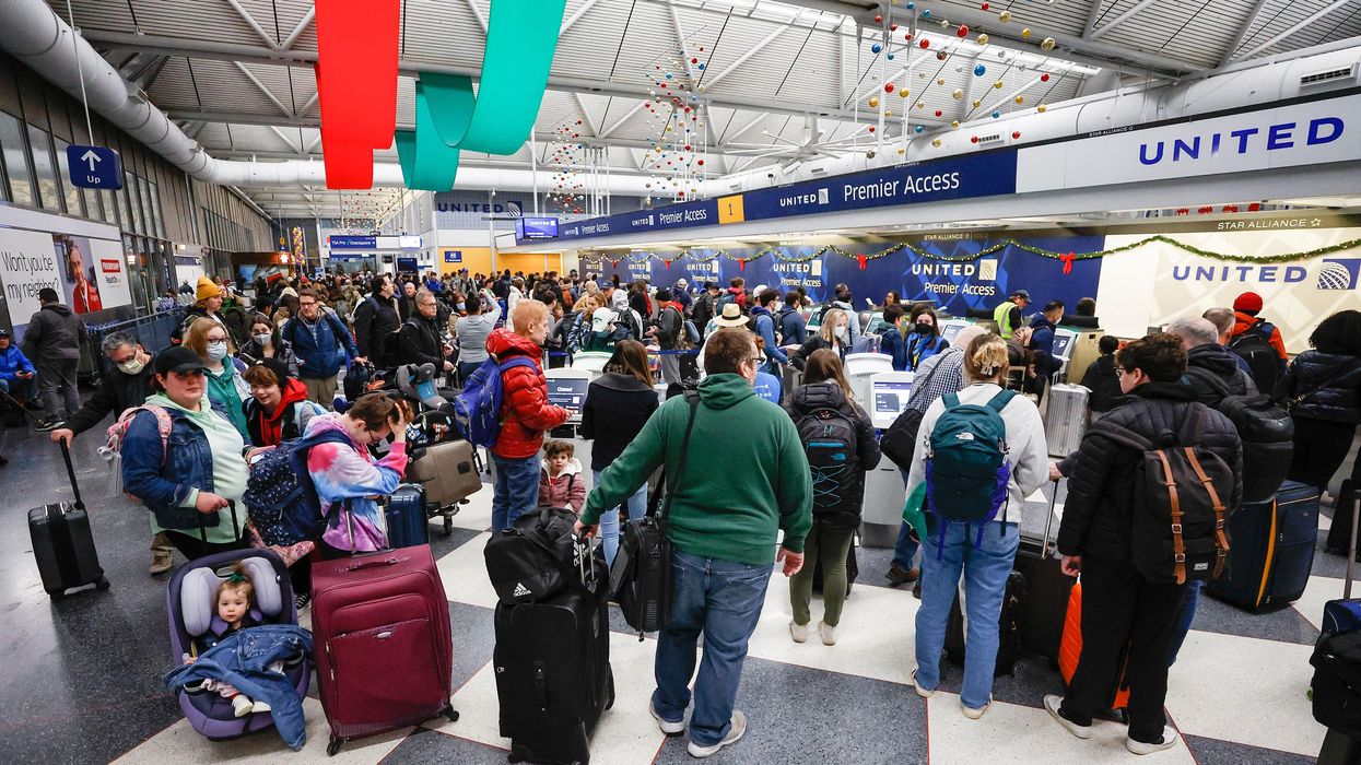
Travel is also being snarled, with hundreds of miles of road closures and flight cancellations growing rapidly. The storm is also causing coastal flooding, particularly in the Northeast.
Ahead of the holiday weekend, more than 200 million people in the US are under wind chill alerts from the Canadian border to the Mexican border and from Washington state to Florida, with below-zero wind chills expected in the Southeast by Friday. Other winter weather alerts are in effect for blizzard conditions, ice, snow as well as flooding.
"The National Weather Service's Watch Warning graphic depicts one of the greatest extents of winter weather warnings and advisories ever," the agency said Thursday.
Notably, parts of Montana, South Dakota, and Wyoming have already seen wind chills below minus 50 degrees Fahrenheit in the past two days.
"The ongoing major winter storm will continue to produce areas of heavy snow, strong winds, and life-threatening wind chills through Saturday. If traveling for the holiday, please use extreme caution and pay attention to the latest forecasts and updates," the National Weather Service said Thursday.
Storm expected to become 'bomb cyclone'
On Friday, the storm is expected to unleash more heavy snow and blizzard conditions, particularly in the Midwest.
As it treks east across the country, the storm is expected to become a "bomb cyclone," a rapidly strengthening storm which drops 24 millibars of pressure within 24 hours. The storm's pressure is forecast to match that of a Category 2 hurricane as it moves into the Great Lakes on Friday.
Governors in at least 13 states, including Georgia and North Carolina in the South, have implemented emergency measures to respond to the storm. Declarations of a state of emergency in several states have included the activation of National Guard units.
Plus, more than 6,000 flights in the US have been canceled as of 11 a.m. ET Friday, according to FlightAware, with particular issues at airports in the Midwest.
It will remain very cold: Friday will bring record-low temperatures in large swaths of the US, including from the Lower Mississippi Valley, northeastward into the Tennessee and Ohio Valleys, and stretching across large sections of the east from the Southeast, through the Southern to Central Appalachians, and into the mid-Atlantic, according to the National Weather Service.
Dangerous wind chills: The plummeting temperatures will be accompanied by high winds, which will create dangerous wind chills across nearly all the central to eastern US.
Blizzard warnings: The Upper Midwest will see frigid temperatures, heavy snow and high winds. The warning applies to parts of Iowa, Minnesota, South Dakota, North Dakota, and Michigan. Buffalo, New York, will go under a blizzard warning Friday morning. Such warnings go in effect when snow and wind of 35 mph will reduce visibility to less than a quarter of a mile for at least three hours.
Whiteout conditions: Blizzard conditions may exist even if snowfall stops, because high winds can pick up snow already on the ground and cause low visibility.
Plunging temps
One of the biggest dangers of the storm besides heavy snow and blizzard conditions is the rapid drop in temperatures over a short period of time. The air will continue to get and feel colder, especially during night hours.
More cities are experiencing rapid temperature drops as the arctic air that blasted much of the Western US and Great Plains this week heads east.
Denver: Over the course of one hour, Denver International Airport saw a 37-degree plunge Wednesday, preliminarily the biggest one-hour drop recorded there, according to the National Weather Service.
Chicago: Over 11 hours on Wednesday, Chicago's temperature dropped 38 degrees; in wind chill terms, a drop of 53 degrees, from 27 degrees Fahrenheit to minus 26.
St. Louis: Over 24 hours from Tuesday to Wednesday night, St. Louis' temperature dropped 44 degrees — in wind chill terms, a drop of 61 degrees, from 31 to minus 30.
Memphis: Over six hours on Wednesday afternoon and evening, Memphis' temperature dropped 36 degrees — in wind chill terms, a drop of 54 degrees, from 40 to minus 14.
Nashville: In just two hours Wednesday night, Nashville's temperature dropped 29 degrees — in terms of wind chill, a drop of 41 degrees, from 39 to minus 2.
Dallas: Over nine hours Wednesday, Dallas' temperature dropped 31 degrees — in terms of wind chill, a drop of 44 degrees, from 40 to minus 4.
Little Rock, Arkansas: Over nine hours Wednesday afternoon and night, Little Rock's temperature dropped 36 degrees — in terms of wind chill, a drop of 52 degrees, from 41 to minus 11.
Cheyenne, Wyoming: Over about one hour, temperatures in Cheyenne dropped by 43 degrees. The capital city also saw a 30-degree drop in temperature in 10 minutes.
The-CNN-Wire
™ & © 2022 Cable News Network, Inc., a Warner Bros. Discovery Company. All rights reserved.