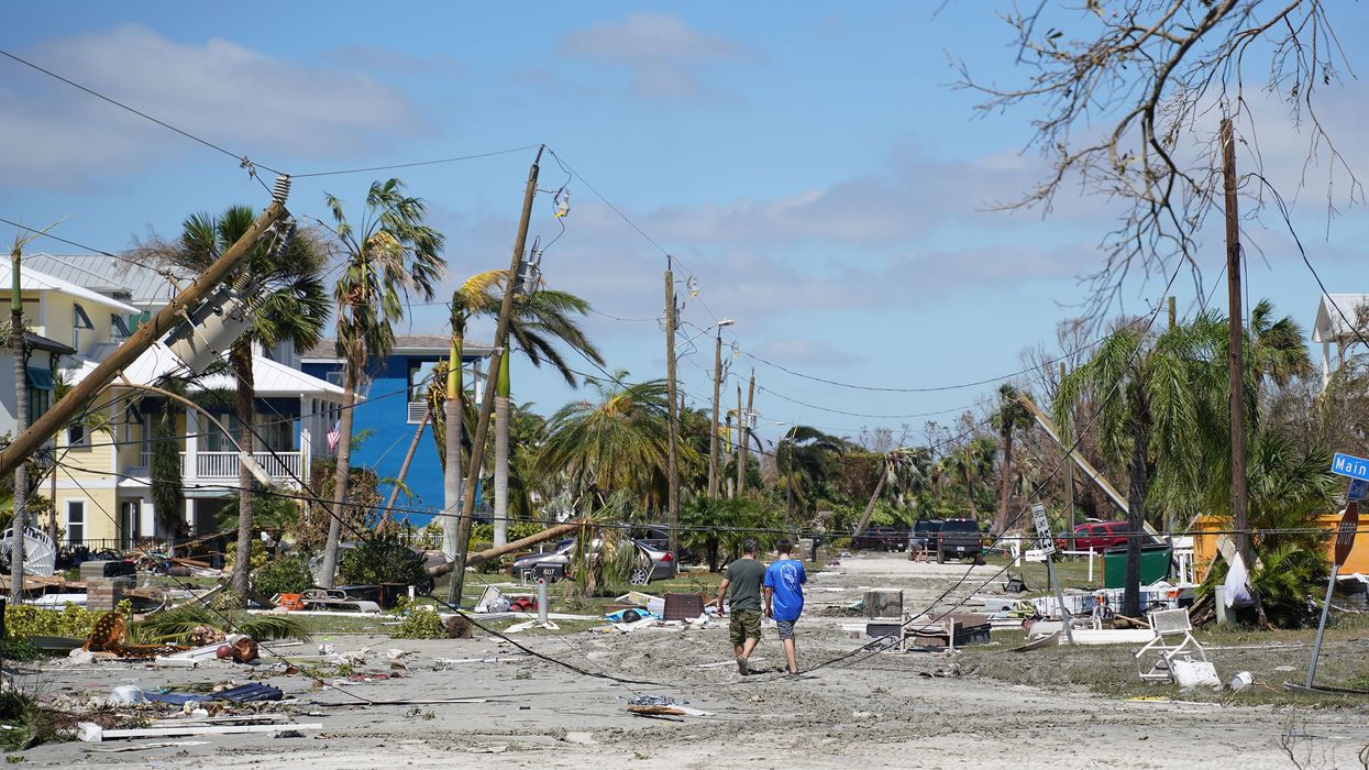
(CNN) — As the planet warms, hurricanes are changing — they are getting stronger faster, bringing more flooding rain, pushing farther inland after they make landfall, and tracking farther north in general.
Those changes are exposing more people and properties to hurricanes' damaging winds, according to a new report from nonprofit organization First Street Foundation — with the potential to cause millions of dollars in damage in the coming decades.
Importantly, the report lays out how homeowners' financial loss from hurricane damage is likely to increase significantly in surprising new places, including the Mid-Atlantic and Northeast.
The First Street analysis, which covers the next 30 years — or the typical life of a home mortgage — shows Florida and the Gulf Coast will continue to have the largest magnitude of financial loss from hurricane damage. But the future holds a significant uptick in damage for regions that previously have tended to be safer from the most devastating storms.
For instance, First Street found the top 20 US cities with the highest likelihood of being hit with a major hurricane in 2023 are all in Florida. Over the next 30 years, though, New York City would see the largest percentage increase in average annual loss due to strong hurricanes, followed by Newport News, Virginia, and other coastal communities in the Mid-Atlantic. The report also highlights Southeast cities like Charleston, South Carolina, and Savannah, Georgia, as notable future hot spots.
"Hurricanes are making their way northward. They're making it latitudinally up to places they haven't before," said Matthew Eby, founder and CEO of the First Street Foundation. "The second thing that comes along with that is they're stronger."
First Street is known for analyzing flood risk that comes from more rainfall, rising seas and higher storm surge, but Eby said the group also wanted to capture how many properties were at risk to increased wind damage from stronger storms fueled by climate change -- and where in the US they were.
"We had half the story that comes from hurricanes with our flood model," Eby said. "The other half of the story with hurricanes is the tremendous amount of wind force they have."
Storms moving farther north and inland
Human-caused climate change — which is warming the oceans and atmosphere — isn't producing more hurricanes. But scientists have long said that it provides more fuel for stronger storms.
The probability of a hurricane in the North Atlantic strengthening into a major storm — a category 3 or higher — has increased from 10 percent in the 1980s to 40 percent today, according to the National Oceanic and Atmospheric Administration.
"The odds of it being a major hurricane when it makes landfall are almost 50-50 now," Eby told CNN. Even after it makes initial landfall, stronger and more-intact storms can persist longer over land, where they can dump incredible amounts of rain and bring high wind speeds to areas that aren't prepared for them.
First Street's report also finds it more likely that hurricanes can form farther north, where communities are typically less resilient to hurricane-force winds than Miami or other Florida cities who are no stranger to these dangerous storms.
"The South Carolina and Georgia border is where you'll see the largest increase in wind speeds over the next 30 years," Eby said.
Charleston was hit hard by Hurricane Matthew in 2016; though the storm was just a category 1, its storm surge was significant for the South Carolina coast, pushing water levels 3 to 5 feet above normal. But it hasn't had a truly devastating storm since Hurricane Hugo slammed into the city in 1989 as a category 4 with 140-mph winds and became the costliest disaster on record at the time.
The area around the Georgia-South Carolina border has largely been spared from the worst hurricane landfalls because of the way the coastline bends inward. Most major hurricanes that strengthen in the Gulf of Mexico or warm waters of the Caribbean will hit another coast first — usually Florida.
But that could change as storms strengthen farther north in the Atlantic.
Hurricane models from prominent meteorologist and Massachusetts Institute of Technology professor Kerry Emanuel, which First Street used in its report, also show current and future hurricanes having a "tendency to form a little bit north in the Atlantic," Emanuel told CNN.
The problem, Emanuel and Eby said, is that stronger and more northward storms could be slamming into areas that haven't yet established resiliency to hurricanes.
The increase in hurricane wind speeds for Florida "will be fairly mild compared to the increases in the mid-Atlantic states and New England," Emanuel told CNN. "In Miami, 100 mph wind is serious but not devastating because they're used to it."
Assessing risk
The problem with many hurricane models used by the government, insurance companies and banks to assess risk is that they're out of date and lack sufficient historical data, according to Emanuel.
"The bottom line is the models that are being used by the existing [catastrophe] modeling industry are based strictly on historical statistics," Emanuel told CNN. "The historical record isn't very long, and it isn't very good when you get back to before 1970."
The other issue is that hurricane models aren't good at taking climate change into account. Emanuel developed his own physics-based model of present and future hurricanes that has tracked recent major storms accurately and which First Street used to create its report.
"This is a big deal for the insurance companies, and they've woken up recently to this," Emanuel said. "The estimates of risk they use to price properties and premiums are 50 years out of date, and the climate has changed enough to make their data useless."
Part of First Street's design is to provide this data for individual homeowners to help make their homes safer and more resilient to storms. But Eby and Emanuel said they hope it is also used by the government and financial and insurance companies to either make communities more resilient or move them to areas that are safer.
"We're really hopeful that our data can do that, to have the risk illuminated for them to make the right decisions," Eby said. "Now they're armed with that data, they can make those smart decisions. That's really the hope."
The-CNN-Wire
™ & © 2023 Cable News Network, Inc., a Warner Bros. Discovery Company. All rights reserved.
- How Christians View Climate Change ›
- How Climate Change Leaves Women at Risk of Domestic Violence ›
- Tropical Storm Ophelia Closes In on the East Coast ›